Tree Planting Summit Rd 11 June 2025

Leader: Chris S

Tail ender: Judy R

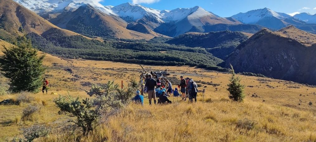
On a dismal misty morning, despite a not very flash forecast, 32 trampers set off on our annual tree planting day at Greenwood Park, in the Port Hills. After a short ten-minute walk we arrived at our planting area, at 10am, directly above Jollies Bush and overlooking Sumner.

We were met by park ranger, Fiona, and her helper, who had prepared all the planting patches, provided 400 plants and the necessary shovels and gloves so we could complete the job.  After a brief demonstration by Fiona, we all got stuck in. It was a very muddy exercise, the ground being soft and waterlogged after the big southerly storm of the prior week. Folk took a brief morning tea break and by about midday we had completed the planting.

All the native plants provided had been propagated from seeds collected from remnant forests in the Port Hills. Varieties included pittosporum, broadleaf, five finger, ngaio and ribbonwood. Fiona explained that after 10 years the planted area would become self generating, as the plants would be of sufficient size to restrict grass growth below, allowing seeds to fall directly on the ground.

Planting complete, we set off walking down a very muddy Eastenders track to our lunch spot at Moncks cave. By about 1:15pm we were climbing the steps to the cave entrance.

After our lunch break, we walked down the Cave Loop track to Barnett Park, arriving at 2:30pm, where the bus was waiting.

We had time to stop off for refreshment at the Brickworks, satisfied that the rain had held off allowing us to complete the planting.

Text by Stuart C

Camp Saddle 21 May 2025

Leader Mentor Tail Ender
Standards Brent Steve B Judy S
Alternates Bev Wendy Tessa

Statistics:  Time 5hr 35 min; Distance 13km; Elevation 750m

On a crisp and clear late autumn morning 21 of the 33 trampers set out from Mistletoe Flat for this season’s Camp Saddle circuit. Judging by a few recent emails this trip was keenly anticipated. Also, being a little later than usual in the season and after a few southerlies over the last month, some discussion on the bus revolved around encountering snow and ice on the route. We were not disappointed.

At 10:25am we began the walk up the Broken River road for 3 or 4km to access the Camp Saddle track, stopping for morning tea briefly at the junction to the environmental education centre.  We arrived at the bushline at 12:20pm in brilliant sunshine and a few centimetres of soft snow on the upper reaches of the track to the saddle.  Gaining the saddle, we stopped briefly then climbed the 60 or so metres for our lunch break at point 1550 metres, the day’s high point. With significant snow up high, we were rewarded with a magnificent view over the Craigieburns, from Hamilton Peak just visible to the north west, directly down the valley to the ski field and looming large across the valley, big Mt Manson.

After our lunch break we walked for about 3km along the undulating and, in some parts, gnarly south east ridgeline encountering light snow and ice in patches where careful footing was required. Everyone negotiated this travel well which brought us to the top of the scree slope for our descent and access, for our return, via the Luge/Mistletoe track.

We were faced with a snow-covered scree slope descent of 250 vertical metres to the head of the track. After some initial trepidation, and a few slips on the way, everyone managed the exhilarating scree descent safely. Thankfully the snow was soft and not icy. On reflection heavier footwear with stiffer soles would have made descending the scree slope easier.

At about 3pm we were on the track to the Broken River road arriving at the bus just after 4pm. A bluebird day of alpine tramping with approx 750 metres of vertical ascent on a 13km circuit.

The Alternates ascended Helicopter Hill walking up the access road then turning right on to the Luge track to Lyndon Saddle then the summit for lunch.  Returning to Lyndon Saddle, they turned to the Craigieburn Forest track then on to Sidle 73 track to the bus.

Text by Stuart C

Greta Valley 14 May 2025

Leader Mentor Tail Ender
Standards Frank Brent Shirls
Alternates Ali Sally Moira

Statistics:  distance 14km, elevation gain 530m, time 4hrs

It was a rather grey, drizzly morning as our bus departed from our Bishopdale pickup point.  Collecting one tramper on the way, we numbered 33.  As our new President was unwell the Past x 4 President officiated on the bus microphone with details for the day.  The Standards and Alternates were to walk the same route but in two groups on what is an easy to moderate farm walk over undulating country.  The bus dropped us off on the western side of SH1 at Greta Valley Village and the Standards set off first just after 10am.  The day was starting to clear and it was pleasant to see the sun although it was accompanied by a rather cool breeze.

We made our way steadily up a hill following a farm track. Our Leader, Frank, had the huge responsibility of making sure we followed the correct farm track as, to the uninitiated, there seemed to be options, and there was some debate over taking the high road or the low road at one point (it was the high road)! When stopping for morning tea and lunch, we sought sheltered spots and admired the views over the surrounding countryside. Jackets, hats and beanies were put on and off all day due to fluctuating temperatures caused by wind direction, sun and exertion.

As we walked, we admired the beautiful, lush countryside. The cattle and sheep looked in great condition.  The cattle found us particularly interesting and wanted to have a good look at us as we walked past. The farmer, who had been busy rounding up sheep, came over to let us know our bus had got stuck turning round at our pickup point and he was (very kindly) off to tow the bus with his tractor.

When we set off after lunch we walked through track covered with a very stalky plant which seemed to have taken over where a pine plantation had been harvested. There are quite a lot of pine plantation plantings on the property and we noticed some had grown considerably since our last visit. When back into the pasture paddocks, one lonely sheep took exception to seeing us coming and impressively shot cleanly through a fence without any apparent damage while we watched in shock and awe! Hopefully she found her friends on the other side.

Nearing the end, we all had to walk through a boggy bit needing careful navigation and a misstep meant rather wet boots and muddy trousers.  Some of us were more skilled at keeping dry than others.  It was not surprising to find a wet patch after all the recent rain.  The Standards arrived at the bus which was waiting at out pickup point, Glen Clova Station, at the end of Gibbs Road, at 2pm followed by the Alternates at 2.30pm.  The bus was looking none the worse for its bogging apart from muddy tyres. We were all pleased to change our shoes and get on it to warm up.  It was another great day out in good company and we were back in Christchurch before 4pm.

Text by Judy R

Mt Alexander 7 May 2025

Leader Mentor Tail Ender
Standards Peter M Brent Lynne R
Alternates Bev Ali Maureen

Statistics: distance 15km/10.7km, elevation gain 672m/390m, time 4hrs 30mins/4hrs

At Bishopdale, Steve had finished his roll call of 39 (later amended to 38) on a crisp 3 degrees morning but at 8.30am there was still no sign of the bus. Ten minutes later Viktor arrived having already completed a school run.  Excited to see Viktor again, we forgave him the fact that this bus was missing some of our usual bells and whistles such as a microphone.

At Woodend with two more trampers collected, he removed the school bus sign as he didn’t want to shock anyone seeing the very mature students inside. Graham gave the info for the day’s tramp while the bus was stationary. A brochure was handed around advising of “SCAMP”, lightweight short stretch gaiters ideal for trail shoes or low-rise boots that could be purchased for $30. There is a good range of colours with artistic patterns to brighten your day.  While walking, I heard one tramper who made a recent fashion statement saying he thought he could purchase 3 pairs in hot pink and sew them together, but even then I don’t think they would reach anywhere near his shorts. The info to be placed on the website noticeboard.

By 10.30 Viktor had us parked outside the museum at Foxdown Farm where 26 Standards followed by 12 Alternates set off up the farm road to enjoy morning tea in the atmospheric sheep yard with the impressive drystone wall.

Onwards and upward, looking for the trig on the top of Mt Alexander. As is often the way when we rounded a corner and spotted the trig it looked relatively close but you round another corner and it looks further away. We were surprised by a strong northerly wind as, in the forecast, winds were to freshen later in the day. At 12.35 lunch was taken sheltering below the trig with the bank for protection, on a level with the radio masts. The Alternates, having made good time, arrived soon afterwards. A few hardy souls made it to the trig.

Standards were now on the eastern track which provides a loop back to the bus. They were initially excited with the downhill but this was soon interspersed with steep uphills in a ferocious swirling northerly which sent a name tag flying, luckily caught on a fence, caps leaving heads and sun hats with the brim bent backwards. If you stretched out your arms you felt you could fly but most likely into the nearest fence. The final section after crossing the stream was boggy as usual but otherwise underfoot was perfect with lush green grass and dry tracks. No drought this year. The Alternates who retraced their steps reached the bus at 2.50pm and the Standards at 3.15. A quick look at the classic cars then back to Christchurch at 5pm.

An invigorating day in the country air with panoramic views and any cobwebs blown into space.

Text by Kate

Bellbird Loop 23 April 2025

Leader Mentor Tail Ender
Standards & Alternates Alan Selwyn Judy R

Distance 8km, elevation gain 485m, time 4hrs 20min

24 trampers braved the morning’s cold, windy and damp weather spilling over from Easter’s deluge.  After an initial “false start” resulting in 20 minutes’ delay, the bus delivered us to the Sign of the Bellbird car-park around 10:00am. The decision was then taken to combine the standards and alternates into one group for the day’s hike.

We commenced walking on the western loop, taking Orongomai track, descending 200 metres in muddy and slippery conditions on the track – some care with footing was needed. On the way we experienced some birdsong from the odd bellbird, sightings of a fantail and significant waterflow in the two adjacent gully creeks.

We arrived back at the Bellbird at around 11:30am for our 20 minute morning tea.

After our break, in improving weather, we crossed the Summit Road to the harbour side, heading south towards Cass Peak on the Cass Ridge Track, encountering a half dozen or so walkers ascending from Governor’s Bay.

At the bush gully sign we turned north, descending 280 metres or so, then sidling along the lower slopes for about 1km on O’Farrells track.

At the junction of the Bush Road track we began to climb again. After ascending for about 100 metres we were able to stop for lunch at 1:30pm in the sun, at a point with views over the harbour from Governor’s Bay and Allandale.

At about 2pm we were climbing again towards the Bellbird on the Bush Road track. At the Summit Road the standards took Ella’s track, and the alternates, the Crater Rim Walkway, both groups arriving back at the Bellbird about 2:30pm having completed the eastern loop.

Text by Stuart C

Flock Hill 16 April 2025

Leader Mentor Tail Ender
Standards Alan Graham Brent
Alternates Pip Chris S Tessa

Standards: Distance 11.3km, elevation gain 480m, time 4hrs

It was 40 eager trampers including visitors, Neville (Janne’s husband) and Taylor, that boarded the bus with driver Alan heading west for new tramp, Flock Hill, under gloomy skies. Megan and Mark generously provided “Tariff Candy” wishing everyone a Happy Easter before they head to the wild west on holiday.

Today the land at Flock Hill, so named as in the distance the limestone tors resemble flocks of sheep, is owned by Canterbury University but leased to a manager, LLC, a group of mainly American investors who have developed the luxury lodge. The farm, 36,000 acres with 10,500 merino romney sheep and 400 cattle, is managed by a NZ couple who have kindly granted us access to their station.

At 10.20, 29 standards left the lay-by on highway 73 to walk along the fence line of a seriously fire damaged paddock to join the farm road heading downhill to get amongst the limestone tors. Morning tea at 10.40 on a grassy bank felt early especially when the 11 alternates walked briskly past heading for a grassy patch further on.  We made our way through a broad gully of rocks of every imaginable shape with the weather brighter and little wind, perfect conditions for hiking. The view of Prebble Hill catching the sunlight and the Porter and Broken Rivers was awe inspiring. We reached the ridge for lunch at 12.45 and the alternates, who had taken a slightly lower path below the ridge, enjoyed their lunch still fully immersed in the cool rock vibe.  Alan sprang a surprise for the standards after lunch: one more uphill section to reach a cairn, the official highest point. We passed a man standing on top of a fairly vertical rock but of course with a good woman below holding a padded landing pad.

Two movies were shot here, The Lion the Witch and the Wardrobe, and last year, Bookworm, which is a tween family friendly adventure movie.

We were back at the bus with the alternates at 2.30 after taking a different route downhill, managing to remove stubborn wilding pines on the way. Thanks to this year’s team who had a far gnarlier task than previous years.

To stay at the lodge is $12,000 a night but there are now seven new villas where you can stay for $3956 which includes all meals at the new restaurant and two activities. Please pay BTC sub before surprising someone.

After a refreshment stop at Darfield we were back by 5pm with a resounding thumbs up for the new tramp.

Text by Kate


Weka Pass Farm 9 April 2025

Leader Mentor Tail Ender
Standards Judy R Chris S Frank
Alternates Wendy Ali Moira

Standards: Distance 14km, elevation gain 513m, time 4hrs 30mins

Alternates: Distance 10 km, time 4 hrs

“Easy, undulating, farm tracks, great views”.  That sounds a pretty idyllic walk!

After departing Bishopdale we picked up two strays in Woodend and became a total of 43 willing walkers, keen to undertake this North Canterbury farm outing, in an area not generally accessible to the public. Our driver was Garth, there were 28 Standards and 15 Alternates with three visitors, Diane, Richard and Taylor joining us. Chris H brought along chocolates, always good to celebrate another year, a welcomed treat.

Setting off from the bridge over a very narrow chasm, our boots walked in easy rhythm traversing ancient paths that were first explored by Maori approx. a millennium ago. Not a dinosaur in our group of many retired people – we are more like the feisty and curious weka (DOC bird description). No weka seen today, but a pair of magpies and a hawk soared on a thermal. Also sighted were flocks of sheep, white butterflies on the brassica crop, lots of cow dung – mucky on boots – lush rolling farmland, stunning limestone country.

The “trolley problem” was considered in light of the three gate question, which one to take, what might be the consequence of going through a different gate? The Alternates were definitely on the right path, the Standards were more challenged in choosing, with some strong consultation as to which to follow. Standards also took a longer route, up, over and along different farm tracks.

However, all tracks eventually led to the Old Weka Pass Road and the waiting bus, though not before the Standards had the under or over gate dilemma. Some slimmer members were able to squeeze under the locked white gate, while others clambered over. Fortunately the obstacle was circumnavigated before lunch. Both groups had lunch stops at different barns, the Standards’ one a bit barren, while the Alternates sat comfortably on hay bales or stacked wood. We all bypassed the distinctive deteriorating sheets of metal – more sculpture-like than storage.

Finally at the bus, the Alternates were able to offload the Mega Nuts Chocolate Bar which had been inadvertently left behind on the hillside. The owner of this was deduced from close scrutiny of a photo taken at morning tea. Despite the dramatic views, good company and conversation, alas, there had been a (brief) discussion on divvying up the chocolate bar – or not.

Standards arrived at the bus about 30 minutes after the Alternates. With the early completion of the walk, there was time for a short stop at Amberley to round off another day of adventure with BTC in the great outdoors. Idyllic indeed!

Marie-Therese

Hinewai Reserve 02 April 2025

Leader Mentor Tail Ender
Standards Alan Brent Shirls
Alternates Pip Ali Sally

Distance 12.5km, elevation gain 640m, time 4 -5hrs

This is a popular tramp, which was missed last year due to poor weather, and 38 trampers signed up. However, unfortunately 3 withdrew at late notice for various reasons.   Due to the distance to Hinewai, we had an 8am departure from Bishopdale with a pick up for others at Halswell.

President Jen had advised us that a viewing of a documentary titled “Fools and Dreamers” prior to this tramp, would be informative with regard to understanding the genesis of Hinewai and the work of its brilliant and somewhat eccentric kaiwhakahaere Dr Hugh Wilson.

While travelling in the bus to Hinewai, our club member, Bruce Hansen, who is a long-standing Trustee of the Reserve, gave us an informative background to the origins and development of Hinewai since its formation in 1987.  A chance meeting of botantist Hugh Wilson and philanthropist, Maurice White, provided the spark which enabled it to get underway, with the purchase of 109 hectares of land.  It was non-productive pasture covered in gorse and with Hugh’s idea of minimum interference and letting nature do the regeneration work, Hinewai now has 1600 hectares of regenerating native forest.  While eradication of pests has been a big job and remains so, Hugh’s practice of allowing the gorse to grow and allowing nature to return its seedlings to the Reserve to be ‘nurtured’ by the larger gorse cover, has been very controversial.  However he has proven that the native trees, in relatively short time, outgrow the gorse and kill it off, providing a wonderful forest floor nursery bed for seedlings.  Local farmers and indeed the Environmental Council, with their noxious weed legislation, were not convinced early on and Hugh has fought many battles over the years and won.  Hinewai today is the evidence that it works.

Alan and Jan B had done a prior walk to establish the best route for our groups and we all took off from the Long Bay Road carpark under grey skies and in a stiff, cool easterly. Some of the early gradients were quite steep and slippery and there were numerous falls as we made our way to Jules’ Knob for morning tea.  Apparently this was named after famous Peninsula identity and rugby player, Jules Le Lievre.  It was a rugged knob, worthy of its tough prop namesake.

Hinewai has an extensive network of tracks and we proceeded down Kereru Track towards Long Bay, encountering impresssive bird life.   Continuous serenading by korimako was accompanied by aerial ‘attacks’ by squadrons of piwakawaka, scooping up the insects the group was disturbing.  Nature has done a superb job of reestablishing the forest and there is a wide variety of NZ natives, from the podocarps to the smaller shrubs and bushes. There was some discussion about the food quality of the kawakawa leaves, with the suggestion that those with holes in them must be the most desirable since the insects found them so tasty.

Lunch was taken down on the beach, where a group of retired UC chemists were also having lunch.  This stimulated a discussion about the fact that a number of our trampers could recite the Periodic Table.   No competition with the chemists was contemplated!

The return journey started back the way we came, but we then diverged up the Valley Track, through many more hectares of this inspiring example of how nature can restore a forest, if left alone to do so.  After the big climb up from the beach, we were all glad to see the Visitor Centre and Hugh’s house hove into view, with the bus just a bit further on.

Bruce dealt with a few more questions as the bus descended back into Akaroa and we passed Hugh, pushing his bike up the hill back to his beloved forest, of which he is so proud.

Text by Selwyn

Castle Hill Village to Kura Tawhiti via Leith Hill Slump 26 March 2025

Leader Mentor Tail Ender
Standards Selwyn Chris Joanne
Alternates Michele Ali  Marie-Therese

Distance 9.5/8.8km, vertical ascent 338m, time 4hrs

The walk to Leith Hill Slump and on to the limestone rocks at Kura Tāwhiti (Castle Hill) is a favourite of mine and it must be a favourite of many in the club because our bus was full with 48 trampers on board.

The day was fine and sunny, and the temperature was good for walking – not too hot and certainly not cold.  A light northeast breeze refreshed us.

The leader of the standard group of 31 was Selwyn and in a break from tradition (!!) he began the day with a short briefing on what we could expect.  He asked how many hadn’t done the walk before and then assured them (and the rest of us) that they were in for a wonderful treat.  We were to expect beautiful native bush, plenty of birdsong from the resident korimako (bellbirds) and great views when we got above the bush line.  Selwyn explained the route to be taken noting that we’d begin by following the Hogsback Track then some logging tracks through beech forest before morning tea at the Thomas River.  Lunch would be at the Leith Hill Slump after which we’d sidle along the lower slopes of Leith Hill and out to the highway at the famous limestone rocks at Kura Tāwhiti.

And it all happened as Selwyn enthusiastically predicted!

The alternative group of 17 followed much the same route except that at the start of their walk they bypassed the meander through the logging tracks and the Thomas River in favour of a more direct attack on the steepish climb up to the lunch stop.

Something I looked for as we emerged from the bush just before lunch was any noticeable sign of the devastating fire that burnt just north of this area for five days in December last year, but we were too far away to see anything. The views closer at hand of the Castle Hill basin were great although not as spectacular as when doing this walk in winter surrounded by snow-capped peaks.

As the standard group arrived at the slump just before 12, the alternative group members were swallowing the last of their lunches and they soon headed off to get a head start on the second part of the walk. They kept up a brisk pace because we standards didn’t manage to catch up with them until right back at the bus.

Apart from Selwyn’s enthusiastic briefing at the start, there were no dramas to report – just a very pleasant ramble through the bush and farmland (with permission) of the Canterbury foothills.  The alternative group experienced something of high-country farming life at the end of their walk when they met a large flock of sheep being herded expertly by Castle Hill Station staff and their trained sheepdogs.

After a stop for refreshments in Darfield we arrived back at Bishopdale at about 4pm. A successful day out. Thanks to the many club members who planned, organised, and led the trip.

Text by Warren

Kowai River 19 March 2025 (Cancelled)

Kowai River – the alternate tale of a cancelled tramp

The club was booked for 39 members to walk to Kowai River. The weather was not co-operative for this week (again…) and thus at 0645hrs, this member looked at the cancellation message and went back to sleep.

It was thus with a great surprise that it was 0915hrs when the member again awoke. This is definitely an irregular occurrence, but can be handled with a degree of nonchalance. Followed by a leisurely breakfast and diligent reading of The Press.

So what to do, instead of walking along a 4WD track with the alternates along the true right of the Kowai River (true right being the right bank when facing downstream)? Of very great interest was the return of the astronauts from the International Space Station, two of whom had been stranded in space for nine months. It was breath taking to accompany from afar and watch the drogue parachute deploy and read that Donald and Elon had (apparently) been instrumental in this safe return (?!?). The AI display didn’t quite match the commentary, which was distracting as there was some simultaneous muffin making going on.

But there they were, there they had been, and now they’re back on Earth. I had a lingering curiosity as to what exercise had been done in space, and how they managed to retain a degree of sanity from having been confined for so long. My days out in the hills with a wide variety of companions and conversation are far preferable to being so restricted, though I’m a bit too old for space travel.

Anyway, I was going to be trip writer today and regale a tale or two of the walk to the John Hayward Hut. Instead, I shall leave you with an historic tale of this area, as allowed by the duties of trip writer.

In August 1976 a foursome set out along the Kowai River to do a winter climb of Mt Torlesse. There was a strong nor’west and from the city, the mountains looked inky black. As the weather began to close in, the two women in the party retreated. The menfolk carried on, as menfolk are wont to do, with no discussion or yielding to inclement conditions. The womenfolk waited at the little red roadman’s hut at the bottom of Porters Pass. They waited and they waited, and eventually notified Police that two of their party were overdue on Mt Torlesse.

As written, the weather was not good. In fact, the weather was so appallingly bad on Mt Torlesse that the menfolk reached the top in a blizzard. After several attempts to descend in whiteout conditions, and knowing that there were broad ridges which ended in bluffs, they decided that the best thing would be to wait out the storm. Both were experienced trampers/climbers so utilising their ice axes and a billy, they dug an ice slot near the lee of the summit and lined this with packs and some plastic, topping it with a carry mat which was covered with snow.

The piece de resistance was anchoring an ice axe in the snow at the summit with the billy a’top, and running a climbing rope down to the shelter. The duo then squeezed into a sleeping bag that had been stowed in one pack, and enjoyed a couple of peanut bars, limited rations indeed – after all this was a training trip for a proposed walk in the Himalayas. Carrying a billy and a sleeping bag on a day climb of Mt Torlesse was probably excessive but fortuitous.

Of course, Search and Rescue was deployed, and after a very anxious night for the womenfolk, several groups were out from daylight searching the surrounding areas, with a base at the roadman’s hut. The Face Rescue team was flown as high as possible up the peak. Members of this team climbed to the summit and found the billy, ice axe and snow encrusted rope leading down to the ice slot. The two men were essentially OK though cold, but pleased to be escorted to the waiting helicopter, and soon safely delivered to the women still waiting at the red hut.

One of the men didn’t go on the trip to Himalayas, reconsidered the idea, and instead ended up getting married a few months later to the trip writer who had been waiting at home through the drama. The incident was a watershed moment (for the couple), but was never followed by an attempt by me on Mt Torlesse, nor a walk along the true right of the Kowai River. Forty-nine years later and the weather again didn’t work out. I did however manage a nine km walk to visit a friend.

Text by Marie-Therese